Flowers + Glaciers + Views – Crowds = Brandywine Meadows
Put Brandywine Meadows and Brandywine Mountain atop your list of hikes to do in the Sea-to-Sky corridor between Vancouver and Whistler if you:
- Like wildflowers, glaciers, and waterfalls
- Don't like sharing your hikes with hundreds of other people
- Want a shortcut into the alpine
- Have a rugged four-wheel-drive vehicle
If that sounds good to you, keep reading because this guide has everything you need to know.
Outline of What You Need to Know
Quick Facts: Brandywine Meadows Hike
- Difficulty: Moderate. Getting to Brandywine Meadows from the upper parking lot is easy. Climbing to the top of Brandywine Mountain from the meadows is moderately difficult. The path is steep, with loose gravel, rocks, and boulders.
- When to Go: Late summer or early fall is ideal. The snow will have mostly melted and you'll have a better chance of avoiding swarms of bugs.
- Hike Duration: About 2 hours each way going at a medium pace.
- Distance: 4.5 km (and about 800 meters elevation gain) from the upper parking lot to the peak of Brandywine Mountain.
- Getting There: 2 hours from downtown Vancouver to the upper parking lot. 45 minutes from Whistler Village. The last 30 minute is slow going on rough roads.
- Camping: Yes. There are no public facilities though.
- Dog-Friendly: Yes.

Jump to: Quick Facts | Maps | How to Get There | The Hike | Tips & Resources
Maps
You can save the points on the this map to Google Maps on your phone using our simple instructions here.

We also recommend you download Maps.Me to your phone. It's free, you can use it offline, and it shows the logging roads and hiking paths that Google Maps doesn't.
Jump to: Quick Facts | Maps | How to Get There | The Hike | Tips & Resources
How to Get to the Brandywine Meadows Trailhead
The Easy Part
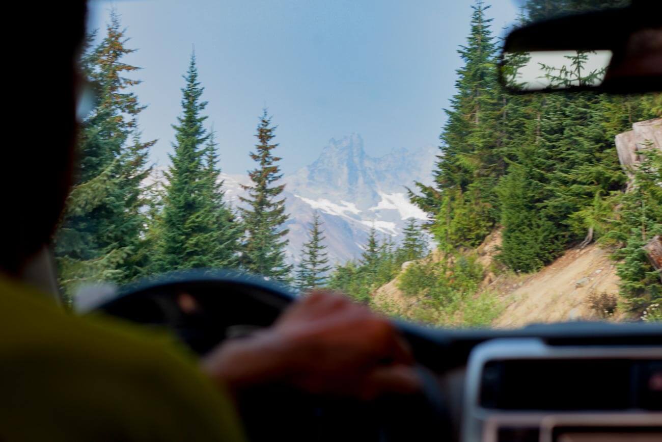
From Vancouver (107 km) or Whistler (14 km) turn west off Highway 99 at Callaghan Road. One kilometer later, take your first left.
The road will turn to gravel as you continue toward Turnoff 1 on the map above. From there until you get to the turnoff to the upper parking lot, which is clearly marked by signs, the road is easily passable by all vehicles.
Then it gets rough.

The Hard Part
As you head more steeply up the hill, you'll eventually hit ditches that will swallow any two-wheel-drive vehicle. If you have a high-clearance 4WD, it's your rare opportunity to use it for reasons other than to feel macho or hold a lot of groceries. If you don't have a 4WD, you'll have to pull off to the side and walk.
Even with a well-equipped vehicle like we had, it's a tricky ride. For example, on our way out we had to help a couple in a Jeep who was struggling with one particularly tricky section.
All-in-all it's about five kilometers of slow going until you arrive at the upper parking lot.
Then the fun part begins.
Jump to: Quick Facts | Maps | How to Get There | The Hike | Tips & Resources
The Hike
The hike from the upper parking lot to Brandywine Meadows is surprisingly short. It's more of a walk than a hike, really.

The trail is in spectacular shape. We even wondered whether they used a backhoe to make it so nice, elevated, and clean. It's impossible to get lost on.
As the trail flattens, the meadow opens up and the peak of Brandywine Mountain, 2,200 meters above sea level, becomes visible straight ahead.

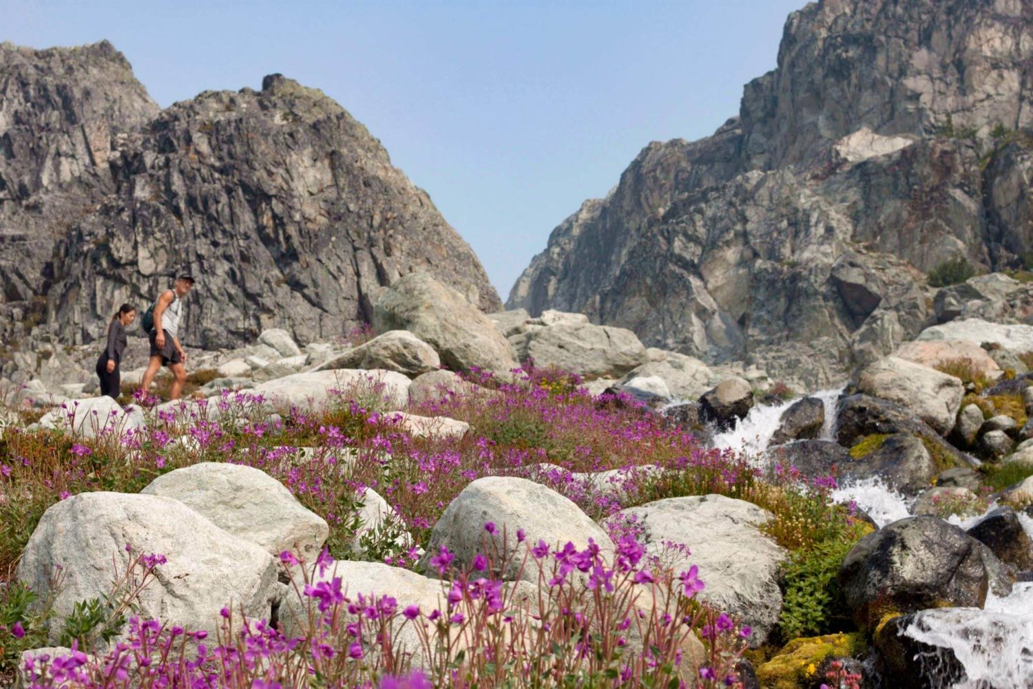
If you come in August, you'll be rewarded with fields of wildflowers.

…but you may also be punished by swarms of bugs. We were lucky. When we went, on August 18, the bugs weren't a nuisance at all.

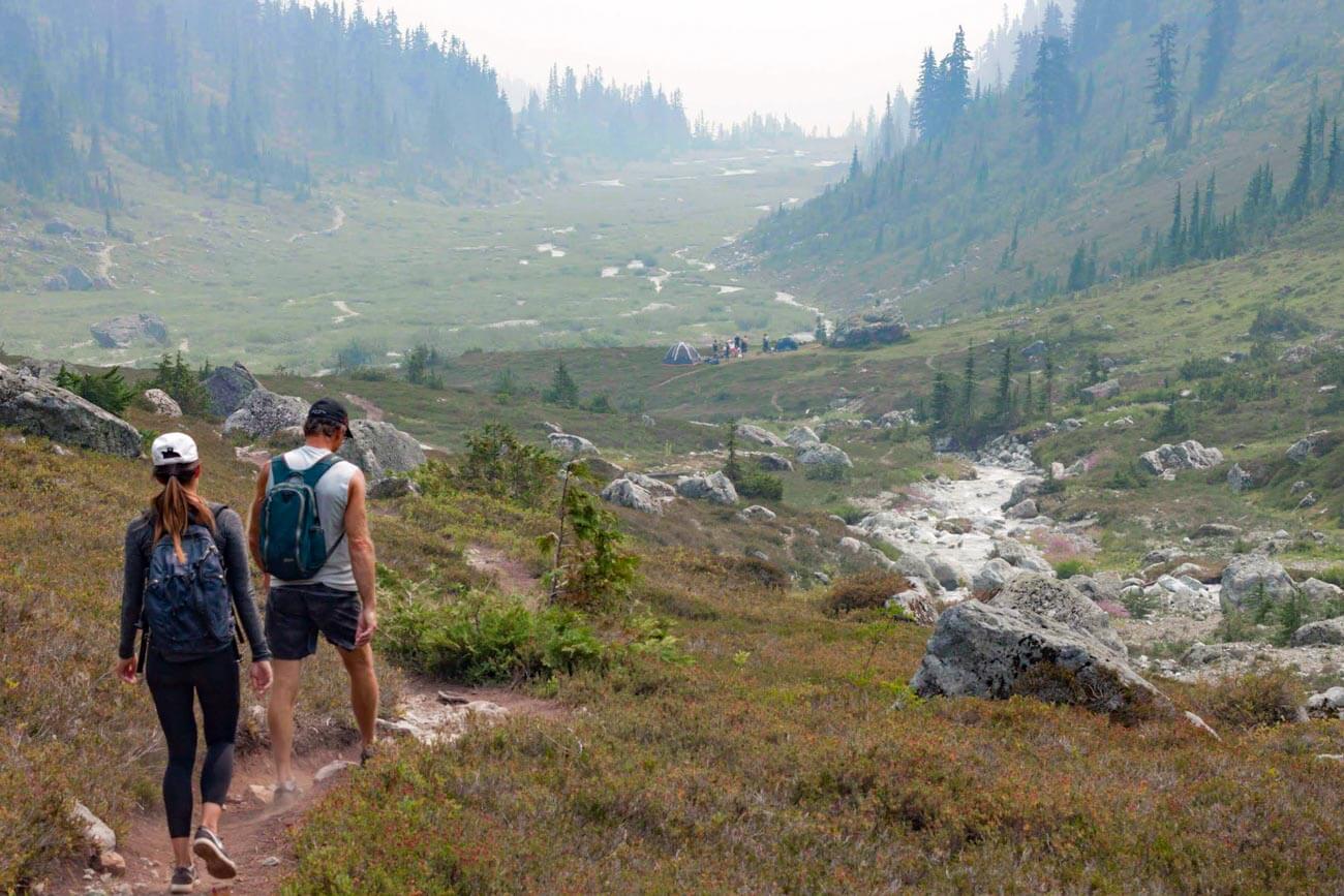
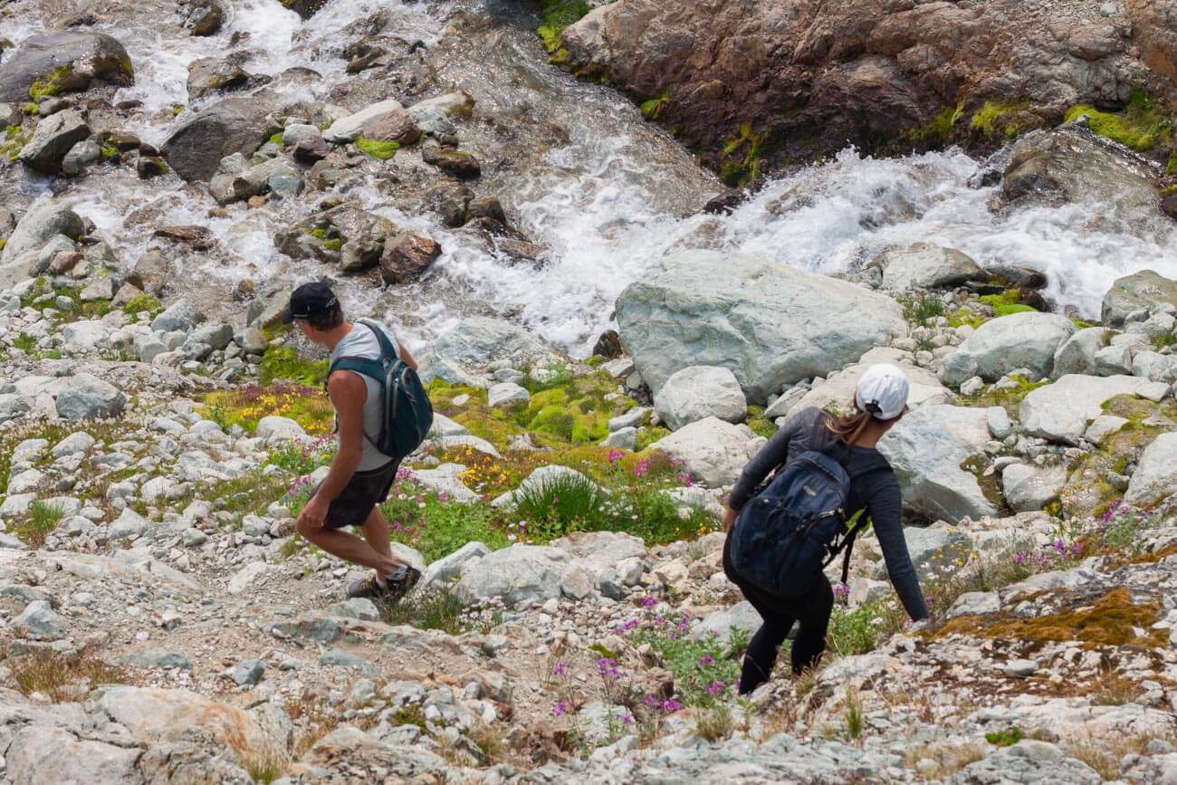
Follow the trail along the creek along the valley in the direction of Brandywine Mountain.
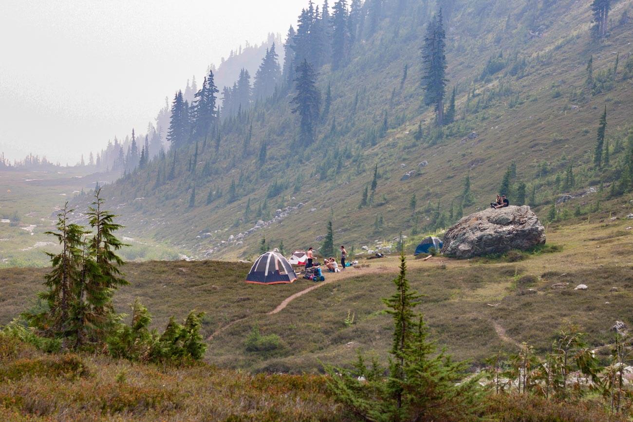
You'll pass by multiple tent sites along the stream. There are no camping facilities, but there are quite a few established spots with fire pits.
Take note of the waterfall to your right as you continue along the valley. We didn't scramble up to the base of it, but you could easily if you had more time.

At the end of the valley, to your left you'll see the trail up to the peak of Brandywine Mountain that's marked on Maps.Me (and other map apps too I imagine).

Go left to follow the route to the top of Brandywine Mountain, follow the stream like we did, or go your own way.
We chose instead to scramble up the mountain along the stream. There is a bit of a path, but you can make your own way wherever you please. It's all open, so you're not going to get lost.

Scrambling up is not as difficult or steep as it seems from far away, but you have to take care not to step on loose rocks.
Aside from loose rocks everywhere, the climb's not too difficult.
We continued on up until reaching the base of a large glacier, as marked on the map. Altogether, including many stops for photos, it took us two hours. If you went non-stop you could probably do it in an hour and a half.

If you come on a clear and sunny day, you'll be rewarded with views of Black Tusk, Mount Fee, Whistler, and much more. Unfortunately for us, we couldn't see anything because of the dense wildfire haze.
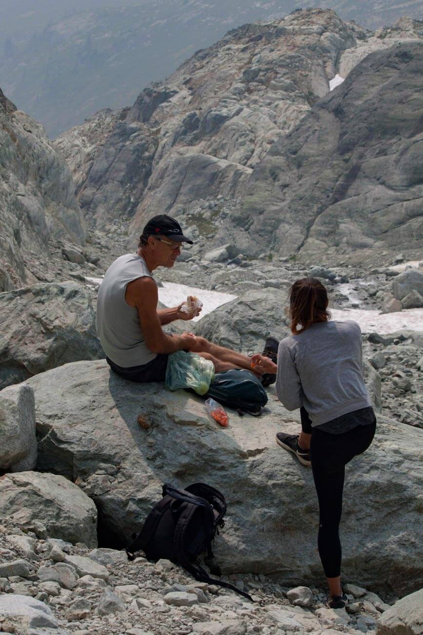
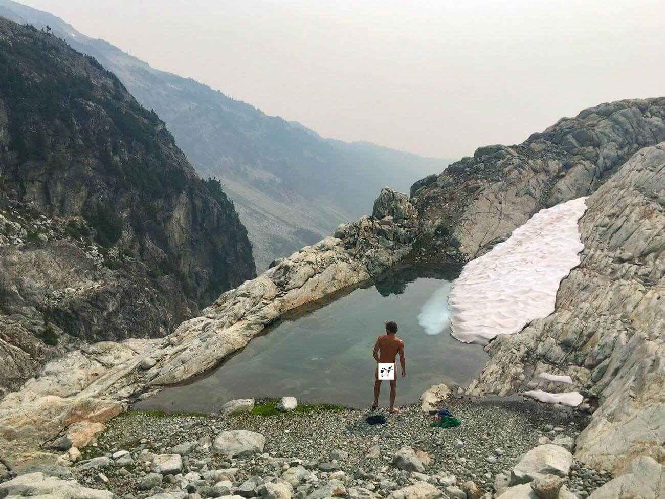
On the way down, we stopped for lunch and veered off a bit to take a refreshing dip in a small glacial pool that still had some ice in it.
If you are as cautious as we were on the descent and take time for a quick dip and to pick some berries, you can expect it to take around the same time to get back to your car as it took you to get up (just under two hours each way).

Jump to: Quick Facts | Maps | How to Get There | The Hike | Tips & Resources |
Tips and Resources
Tips
- Be prepared. There are no camping facilities on the meadows, so bring everything you need. And prepare for it to be hot and exposed in the summer.
- Beware of bugs. Bugs are notoriously bad up until early August and sometimes later. Plan accordingly.
- Go to the upper parking lot. If you can. By all accounts, the old trail from the lower parking lot up (an extra 2 km long and 480 m elevation) is tough to follow, steep, and often muddy and buggy. Even the people we saw without 4WD cars chose to go as far as they could on the road to the upper lot and walk from there instead of parking in the lower parking lot and taking the old trail.
Before You Go
- Check the comments of sites like AllTrails.com, VancouverTrails.com, or even search Facebook and Instagram for updates and feedback from others who have done the hike more recently than us.
- If you don't have GPS, get Maps.Me. It's free and shows all the roads and paths for this hike.
- If you're planning on camping in Brandywine Meadows, click here to see whether a campfire ban is in effect.

The Adventure Continues
For another less-traveled but more-than-worth-exploring hike on the Sea-to-Sky corridor, check out our guide to Anvil Island.
And if you're looking for things to do back in Vancouver, you've come to the right spot. Kim and I are proud, born-and-raised Vancouverites, so we want you to have an unforgettable visit to Vancouver. And we have lots and lots of tips to share to help you do so:
- Our guide to getting to know Vancouver for first-time visitors
- Vancouver travel tips that answer your questions before you ask them
- Our favorite non-touristy things to do in Vancouver
- Checklist of things everyone needs to do in Vancouver's summer
- 8 only-in-Vancouver dining experiences
- The best ice cream / gelato and the best California roll sushi (it was invented here) in the city
- A guide to all the Vancouver beaches (some of which are great for doing rock workouts)
If you still have a question after reading all of these posts, please ask us in the comments below. If you had a blog, you'd appreciate getting comments, questions, and feedback from your readers too, so do us a favor and leave us a note.
Wow! Might add this to my summer 2021 bucket list. I hope they lift the travel advisory.
I second that! See you on the mountains this summer, Gavin.
We're heading out today and I was looking for tips. Thanks for putting this together!
Weather's looking perfect. Enjoy!
I am heading here next week and have been reading and mapping all about this place to be ready! You answered my internal question: Is it possible to get up the 4×4 road a ways, park and then hike the rest instead of the lower parking hike up? So, THANK YOU for your awesome blogging! I am staying overnight and will explore that waterfall as well! Cheers! Nancy
Enjoy, Nancy! And please let us know if you have any updates or extra recommendations to add to this post.
Hi Chris! Thank you for a well thorough report. I can hardly wait! I have a Wrangler with 33" wheels and 2' lift. Think that would be manageable up to the end of the upper parking lot? Your photos have me all excited! Thanks again for such a good blog! Cheers!
Thanks, Joanne. Enjoy the hike!
Hi there, just wondering whether you saw any bear bins in the area for campers or would we have to hang our food up in the trees? Hoping you saw what the campers were doing! Thanks so much!
Hi. Sorry, I don't recall. Highly doubt it though, so prepare to hang!