A Dream Come True
Have you ever hiked to the top of a mountain and, after having your fill of the view, dreamed to yourself, “Wouldn’t it be awesome if I could just paraglide down?”
If so, paragliding in Medellin is your dream come true.
Along with our friend (and amazing photographer) Oskar, we forged a path and completed the mythical hike up, flight down loop. Here’s how you can too.
NOTE: Since many of you might not be crazy enough to hike up, we'll start with the info on paragliding in Medellin and then add the hike guide after.
The Medellin Paragliding Experience
Paragliding is way better than I expected it would be.
The fact that we “earned it” by hiking up definitely enhanced the pleasure, but you’ll have an amazing experience even if you skip the hike and drive up because you had too many aguardientes the night before. (…Maybe you should’ve read these 9 surprising facts about it)


1. Preparing for Liftoff
We flew with local legend and Colombian paragliding pioneer Ruben “RubenFly” Montoya and his team from Paragliding Medellin.
I was expecting a developing-country-level, laissez-faire professionalism level, but I was totally wrong.
It was the opposite my experience in Banos, Ecuador, where I bumped into a pair of guys sitting on a bridge, handed them $5 USD cash, and bungeed off of it.
Ruben’s team made us fill a detailed form, showed us a safety video on an iPad, and even gave us bracelets that said we were covered by their insurance. We couldn't have expected higher levels of professionalism in Europe or Canada.
Our pilots were pros too. My pilot, Luisito, has been flying since the early nineties and travels the world racing in triathlons where swimming is replaced by paragliding.
Both Luisito and Oskar's pilot, Daniel, were clearly paragliding junkies. They love flying, live for it, talk about little else, and do it every day.
We were about to understand why it is so addictive.
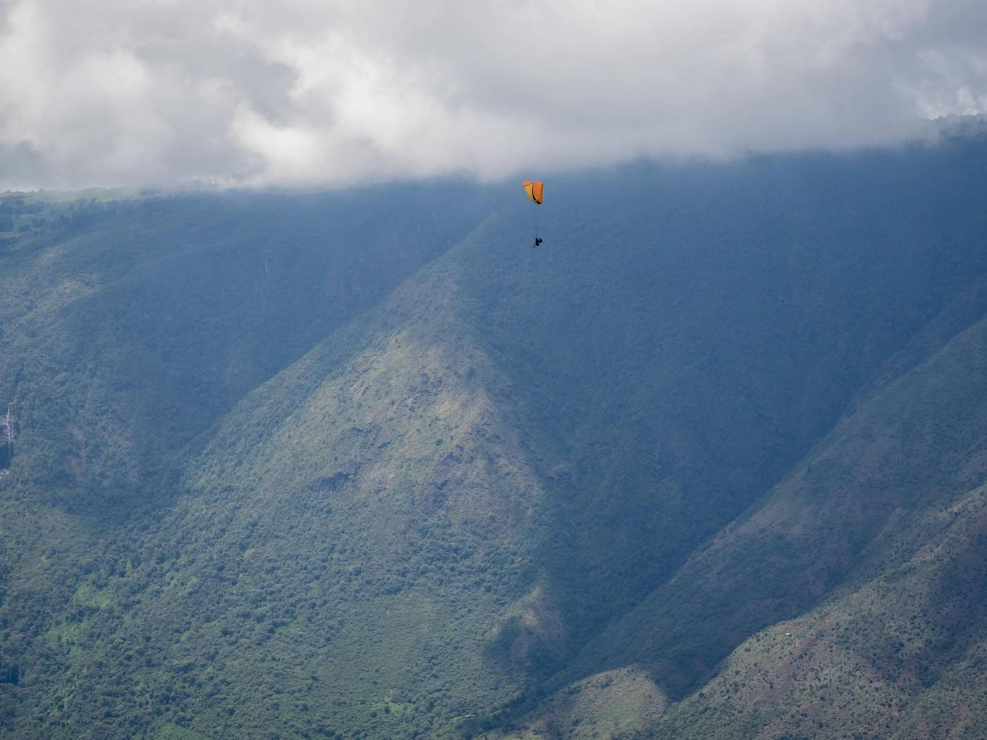

2. Flying Like a Bird
Strapped in with Luisito behind me, I followed his instructions, fought my self-preservation instincts, and jogged towards the cliff.
My bodyweight lightened, my feet started to struggle to reach the ground, and then I was floating.
I felt like my spirit had left my body to float up to heaven, just like in the cartoons. Sitting back in my harness, I couldn't see or feel the pilot or the sail and I couldn't hear anything but the wind. It truly felt like I was flying. It was surreal.
Luisito broke the spell by asking if I was ok then pointing to some vultures up ahead.
“See those birds? We’re going to join them!”
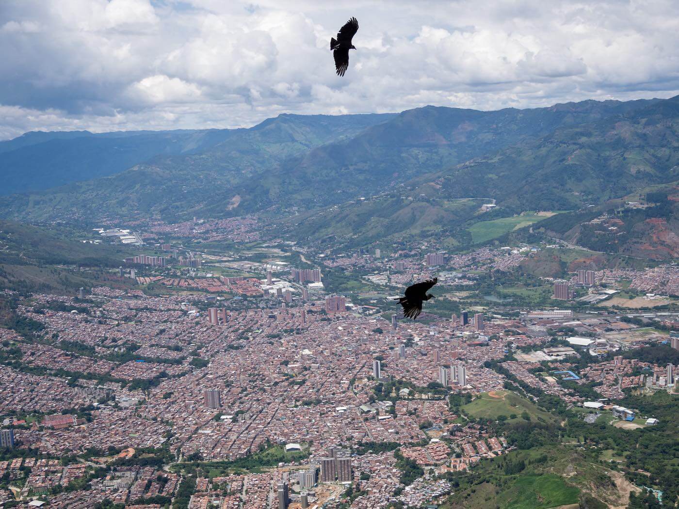
We floated over and started circling up and up, just like them. I hadn’t realized it was so easy to go up, and not just down, while paragliding. Luisito said his longest flight was four hours, and 250 km (!), from Medellin to another town across Antioquia. Amazing.
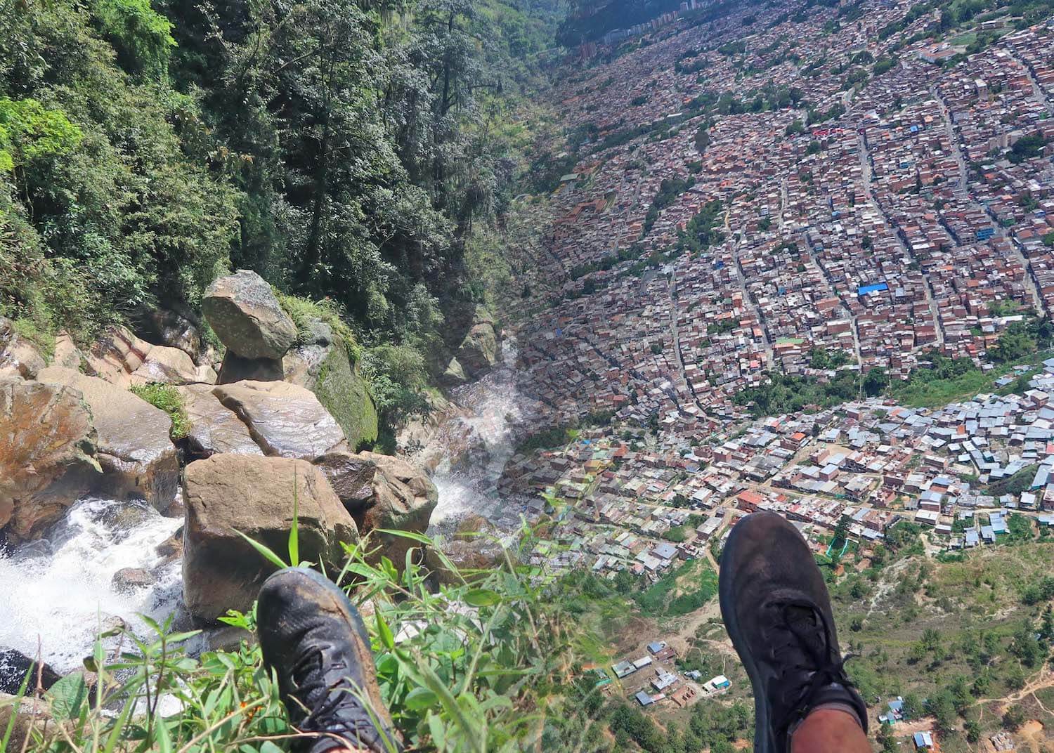
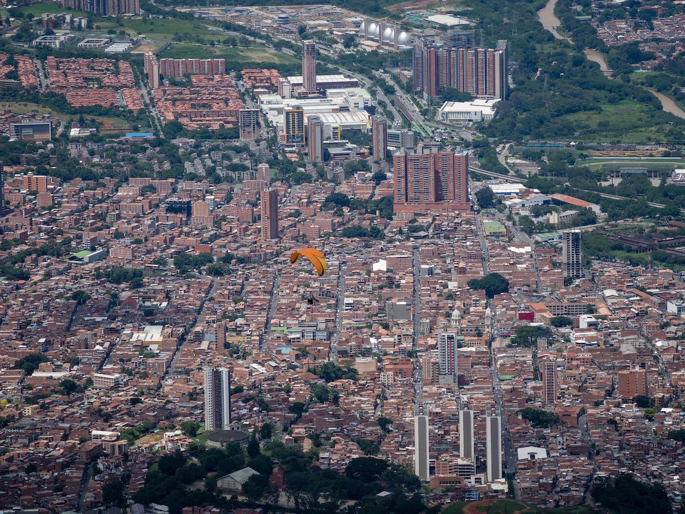
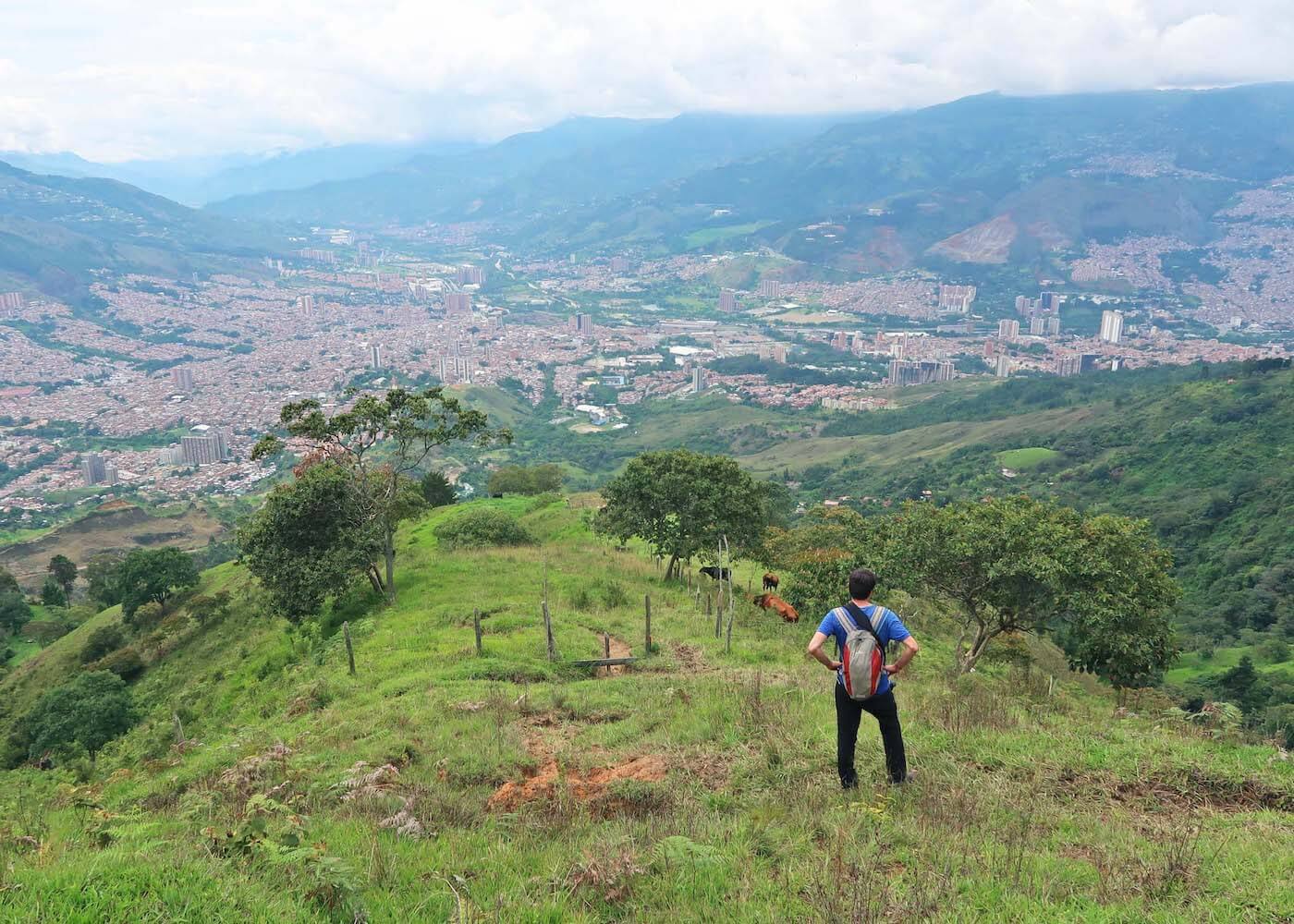
For half an hour we soared around at about 60 kilometers an hour looking down upon the Chorro el Hato waterfalls, the hillside shacks, and the entire city of Medellin to the south. I couldn’t imagine a better combination of urban and natural landscapes to float around.

3. Coming Back Down to Earth
Only as we descended towards the landing spot did I remember that my spirit was still in my body. That wouldn't be for long if something went wrong though, I worried.
Of course, my worries were unfounded. Luisito circled carefully, picked the right moment, told me to hold my legs straight in front of me, and with a painless but abrupt thud we landed.
Like coming down from the high of a drug, my mind and body got reacquainted with each other and tried to figure out what the hell just happened. It was a great feeling. Even some macho guys who were playing it all cool before jumping were giggling like schoolgirls with euphoria after they landed beside me.
Paragliding was even better than I had imagined. Next time I hike up a mountain I’m going to wish even harder that I could paraglide back down.
Tips for Paragliding in Medellin
Flying Down Isn't Guaranteed
As explained in Paragliding Medellin's FAQ, 95% of flights land at the same place you take off up top, so we were lucky to be able to hike up and fly down.
But…
If you're dead-set on landing down below in Bello, it's still possible. Tell RubenFly in advance and he can arrange for it if the weather conditions allow. The only thing is you will have to pay the 20,000 COP or so cost for your pilot to taxi back up to the top.
The Best Time to Paraglide in Medellin
Time of Day
It’s not always possible to paraglide down to the bottom of the hill.
In the middle of the day when it’s sunny, the heat from Medellin’s streets and rooftops sends hot air up and makes it impossible to land below. During these times you’ll land the same place you take off in San Felix and have to bus back to the city from there.
To have the best chances of being able to land below, start your hike bright and early so you make it up to San Felix before 10:30 a.m. You can also come later in the afternoon, but then there’s a high risk of rain and thunderstorms that make paragliding impossible.
Day of the Week
As Dave Richardson points out in the comments, come during the week if you can because during the weekend the paragliding take-off area can get a bit too busy.

How to Get to San Felix from Medellin, and Back Again
If you don’t come with a packaged tour that includes transport and end up having to land at the same place you took off, there are a couple ways to take public transit between San Felix and Medellin.
The less direct, but most memorable public transit route is to take one of Medellin's famous urban gondolas. It's a different gondola, called Metrocable, line than the famous one to Parque Arvi. It's line J, which is connected to San Javier metro station at the end of Line B. Take the Metrocable up three stations to Aurora, where you can then take a bus to San Felix. Ask the bus driver to let you off at parapente San Felix.
The more direct route is to through Caribe metro station at Medellin’s north bus terminal. Information agents at the terminal who can guide you to the San Felix bus and the paragliding crew will show you the stop to go back down.
How to Book Your Own Medellin Paragliding Experience
To fly with RubenFly and Paragliding Medellin, you can contact him (he speaks English) through his website, by email at paraglidingmedellin@gmail.com, or on Whatsapp at +57 310 517 7940.
All the Medellin paragliding companies collude to charge the same prices, so I wouldn’t spend too much time trying to shop around for a deal. That said, hostels seem to get better prices. If you find a better price at a hostel, share it with Ruben and I’m sure he’ll match it.
Hiking Up
Warning:
Reader Jackie notes in the comments that barbed wire now blocks the path to the waterfall and up to the paragliding launch pad. And Kendra said she called the paragliding company and they told her the owner has closed the hike.
If you insist, contact RubenFly (see info above) before setting off to check the status of the trail. In November 2019, he tole me he's working on an alternative route that he could possibly point you to, too.
Make your Medellin paragliding extra special by hiking up by an un-touristed neighborhood, rural farms, an impressive waterfall.
Hike Map
I strongly recommend that you download the Wikiloc app, pay $2.99 for a three-month package and follow our route via GPS.
It will keep you from getting lost. And no, I don't get any commission for recommending the app. If you're still unsure about forking over a few bucks, read some of the comments below from disappointed people who didn't find the trail.
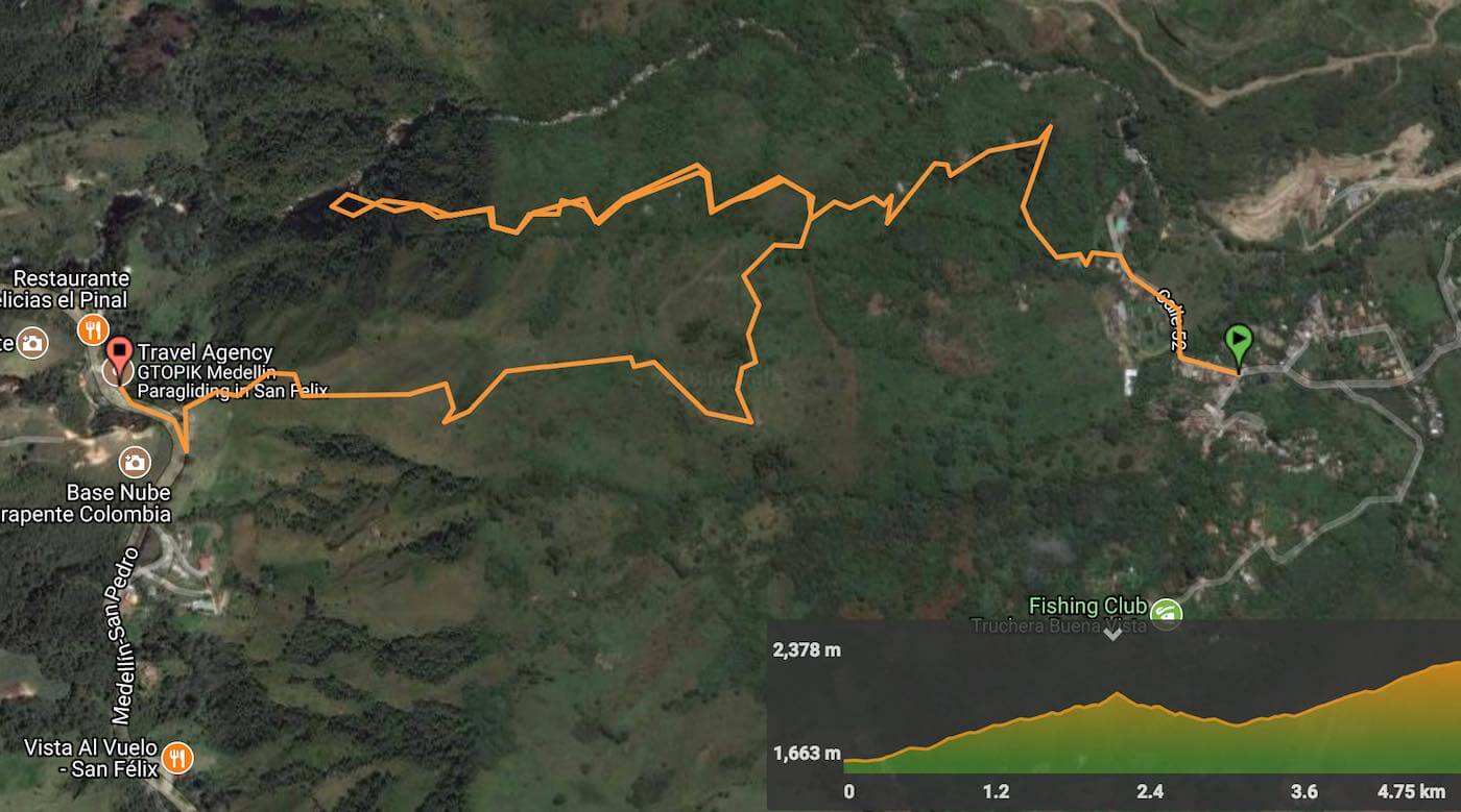
Otherwise, use the points on this Google map as references to guide you on the hike. You can save them to your phone by following these simple instructions.
Quick Facts
- Hike Duration: 2.5 hours to San Felix from the trailhead, plus time for stops at the waterfall. Add an extra hour if you hike from the Bello metro station.
- Hike Difficulty: Difficult. As the awesome folks who shared their own experiences in the comments attest, it's very steep, especially the section after the waterfall through the pasture.
- Distance: 4.9 km from the trailhead to the paragliding area. An extra 4 km to walk from Bello metro station to the trailhead.
- Elevation Gain: 662 m net (880 m climbing, 188 m descent)
- What to Bring: Sun protection, money, a jacket (for the flight), a passport (for insurance), a camera with a strap so you can't drop it, water, and shoes you don’t mind getting muddy
- Cost: The hike is free. Paragliding will cost 130,000 COP (about $46 USD) for a 15 min flight. That's one-third of what it costs, over $150 USD, in my hometown of Vancouver.
Hike Guide
The hike up to San Felix and the Medellin Paragliding takeoff area isn't the most beautiful hike in town (check out our list for other options), but has its benefits:
- Up close view (and swim if you’d like) of Chorro el Hato Waterfalls
- Exercise and fresh air
- 89% more enjoyment of the paragliding than if you drive up
- Ability to brag to your friends, “I hiked to the top of a mountain in Medellin and jumped off,” instead of “I paid for a group paragliding tour where they picked me up at my hotel, shuttled me there, had me float around a bit, then escorted me back.”
If that's not enough to convince you and you don't want to hike up, jump straight to the paragliding section below.


1. Bello Metro Station to Vereda Potrerito
Your first step is to get to Bello Metro station on the A line of the Medellin Metro. Tickets cost 2,400 COP each (or 2,550 if you don't have a reloadable metro card. Thanks to Casey in the comments for this clarification!).
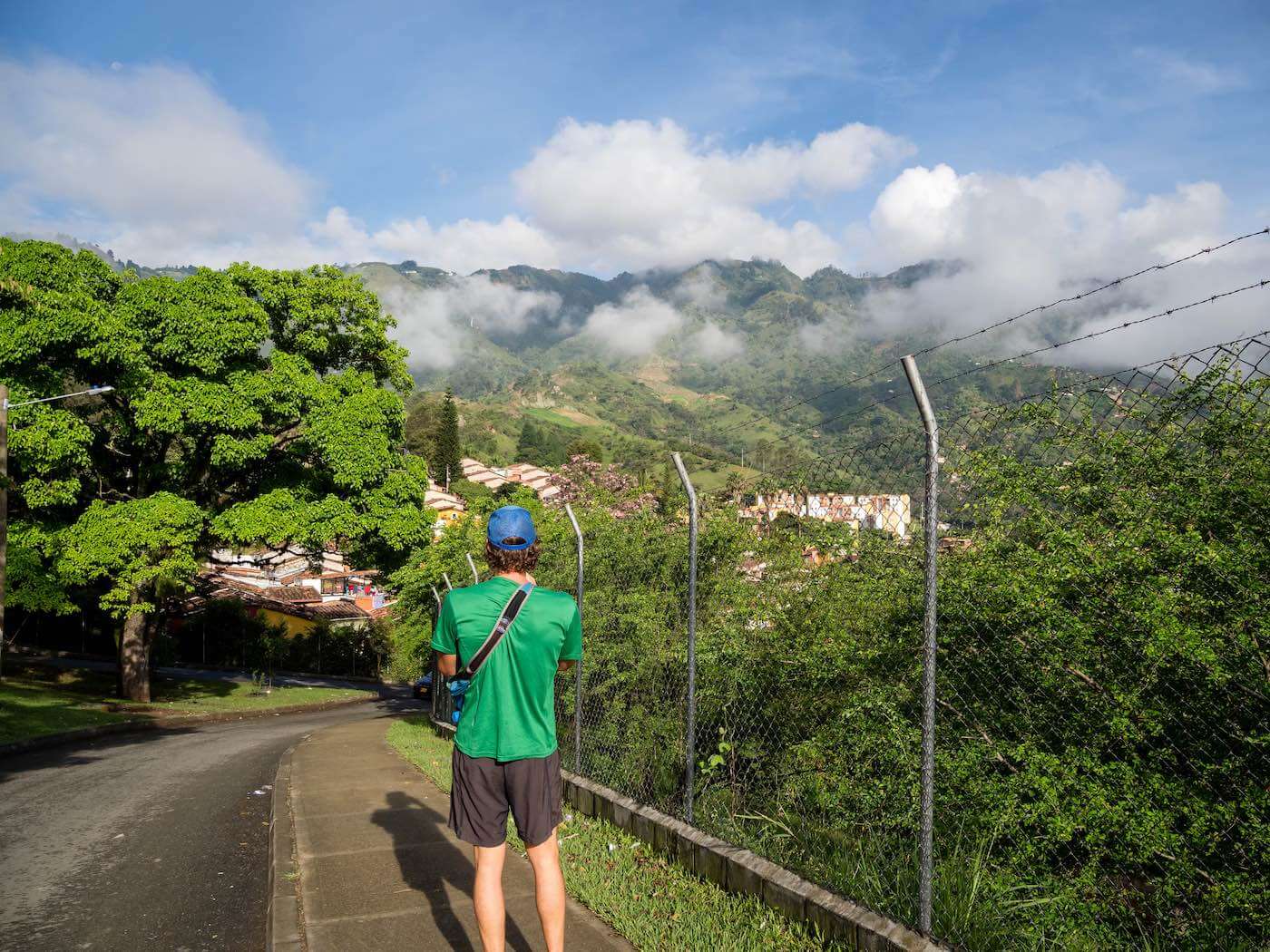
From Bello metro station to the base of the hike is 4 km. On the way, you can explore a totally safe part of town that 99.9% of Medellin tourists don't see and experience how the city recedes—surprisingly quickly—into traditional rural countryside.
You can also bus or taxi to the base of the hike. To bus, look or ask around for one with “Vereda Potrerito” written on the front. It will take you directly to the trailhead (see map below) for an additional 2,100 COP.


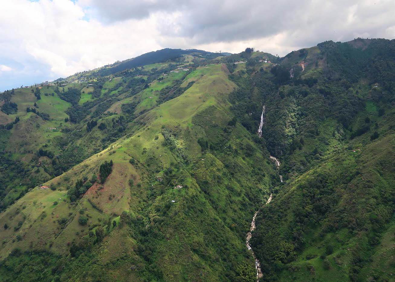
2. Hike to Chorro el Hato Waterfalls (2.2 km, 1.2 hr, 380 m elevation gain)
Use the "Trailhead" point on the Google map above to find the start of the hike, which is before the fence to trout farm and restaurant.
As Amy warns in her comment below, if you pass a restaurant whose owner tries to charge you, you've gone too far.
Most of the first part of the hike is well-used by farmers who live on the mountain. This means the trail is well-defined (yay!) but can get muddy and slippery (boo!), especially in Medellin’s rainy(-er) season, which is when we went.
[Update: Casey mentioned in the comments that she went during the dry season in January and the trail was not wet or muddy at all]
At one point we crossed a young local resident carrying a toddler in her arms. We were amazed at how she sped down oblivious to the slippery mud. It was as is if she had crampons attached to her boots.
Hiking further away from the city and into nature, the trail becomes less used and more overgrown. (Follow the map below to not get lost.) You’ll pass by abandoned coffee and corn plantations, then a pair of deserted houses.


You might even pass some wildlife.
Ten minutes from the Chorro el Hato waterfalls, I sniffed the unmistakable musk of a snake. I stopped in my tracks and saw its slimy, garden hose-thick abdomen three feet away. Looking closer and following along its body, I realized its head was only a foot away! Close call (though I later determined it was a harmless forest flame snake).


3. Chorro El Hato Waterfalls
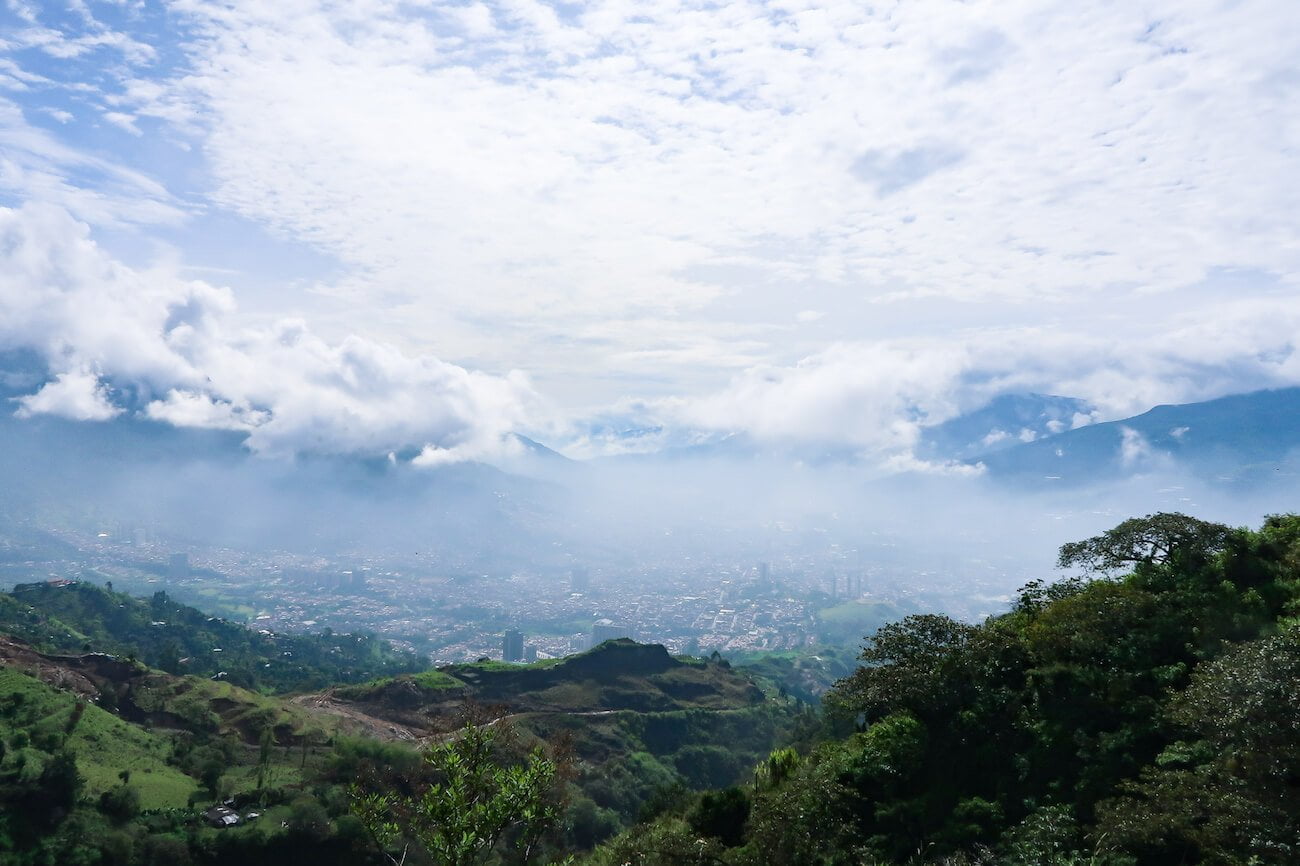
We could see the Chorro El Hato Waterfalls from way down below in Bello, but had no idea they were so big and powerful. And while only one set of falls was visible from below, we discovered there is actually a chain of them.
It’s a beautiful spot to rest, maybe take a dip (the rocks were too wet and slippery when we were there to risk trying to make it into the best swimming pool), and enjoy the moisturizing fresh spray of ricocheting water from the falls.
It's an area that is worth going back to in the future to rappel down instead of paraglide, like in this short clip:
4. Backtrack (0.9 km, 20 min, 140 m elevation loss)
Unless you brought rock climbing gear, to get up to the Medellin paragliding launch spot you’ll have to backtrack just under one kilometer until you get to the turnoff marked on the map below.
The turnoff is where the trees and bush give away to cow pasture, which is what you’ll be hiking up.
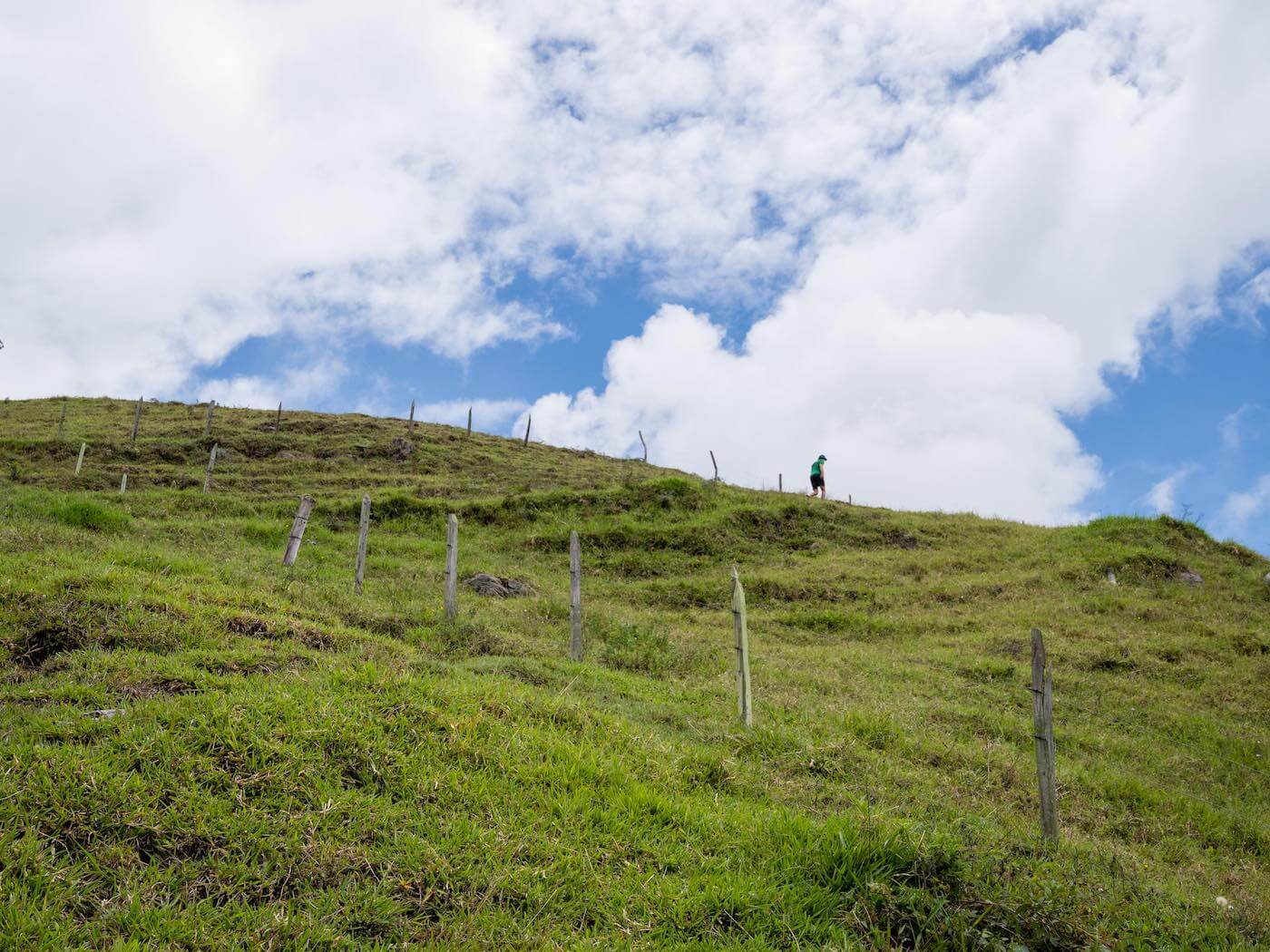
5. Up (and Up, and Up) to Medellin Paragliding in San Felix (1.8 km, 1.2 hr, 420 m elevation gain)
This last part of the hike to the Medellin paragliding launchpad is in open cow field.
The first half kilometer you traverse at a slight incline and go through a couple gates until getting to the farm marked on the map. From there, it’s straight up.
These must be some fit cows because the slope is steep.
There is no defined path. You can choose to go straight up or zig-zag. Just aim for the gates and openings in the fences every couple hundred meters. As you get closer to the top you'll see the wind socks, which you can also use to guide you. (Thanks to Casey for sharing this tip in her super helpful comment below!)
The buildings at the top of the hill are San Felix and mark the end of the hike.
And the beginning of the fun part.
More Colombian Adventures
For all the ingredients you need to put together a magnificent Medellin trip—where to stay, what to do, what to eat, where else to visit in Colombia—see our Medellin Travel Manual.
And if you have any questions, comments, or suggestions to share with other readers, please share them in the comments!
I hope you don't mind me taking the liberty of adding an expert tip: If you a hardcore enough join Kim's workout the day before; your legs will thank you it (as they did for me)
Haha. Fortunately for future hike-up-fly-downers, Kim's not in Medellin these days to destroy their innocent, unsuspecting leg muscles the day before they're needed to hike up a mountain.
We took this recommendation and did this Paragliding experience. I would recommend going during the week if possible because the site can get very crowded on the weekends. We opted for the round trip transportation which was very nice. Our driver spoke fluent English who picked us up from our Airbnb and was able to give us a lot of background information on the city of Medellin during our 60 minute drive to the paragliding sight.
Thanks for this tip Dave. Since we went during the week, I wasn't aware it got so busy on the weekends. I'll update the post with your advice.
Sounds like you guys had a great driver. How would someone else go about reserving with him?
Hey guys!
My partner Jake and I followed your lead yesterday and it made for quite an outing. A quick note that Jake is pretty much a direction wizard so we didn't download the Wikiloc app; he simply pulled up your Google map waypoints and saved them in to his own map so they would be there for offline viewing (if we wouldn't have done this, they would have disappeared). We had a couple additional updates to your article that we wanted to share!
From our hostel near the Estadio metro station, we traveled to Bello. The cost of a metro ticket is now COP 2550 if you don't have the permanent, reload-able card. When we got off at the Bello metro station, it was easy to navigate ourselves through town to the trailhead (and it took about an hour like you said). It definitely was not touristy and we noticed that the prices of things (while already cheap in Colombia) were even cheaper in this area.
As we are in Medellin during the dry season (beginning of January), the hike was not wet at all, which was nice. Because we didn't want to give up our free hostel breakfast – gotta save that $$! but it didn't start until 7am – we arrived at the trailhead at 8:30am. We had made our paragliding reservation for 11:30am, so we skipped the waterfall, which was a bummer, but we didn't want to be late. The hike is steep!
The waypoints helped here and it was also helpful to look out for the wind socks at the top of the hill – they are your guide to the launch pad!
We also flew with Paragliding Medellin. The price for a 20 minute flight is COP 160,000. When we got to the launch area, the guides were rushing us a bit to get in the air because the wind was picking up. It was around 11:45am. We asked if we could land below because we were excited about hiking up and landing down, but he said that the winds would not allow for that. We also saw on their website in the FAQ that in 95% of cases, they have a top landing (http://paraglidingmedellin.com/faq/). We were definitely bummed about this!
I guess the wind continued to pick up during my flight, because we actually had to stall during the last five minutes because the guide said the wind was too strong to turn around. He seemed to have a difficult time during the landing, and we (it felt like) struggled for a couple minutes to get back on the ground. The guys below were yelling instructions to my pilot ("Straight!" "left!", etc). It felt a little hairy. When we finally landed, my stomach caught up to what had just happened and overtook the adrenaline. I get mild motion sickness on some bus rides, but nothing compared to this. Flying was fun and (mainly) uneventful, but I'd consider if the pilots are rushing you off the ground because of changing weather conditions, perhaps reconsider and come back another day!
Thanks again for the post with the waypoints for the hike and sharing your paragliding experience!
Wow Casey, thanks for this amazingly helpful comment. I've made a few updates to the post with your tips. I just wish there was a way to reward people like you with more than karma points for helping future readers by elaborating on what we wrote with your own experience!
My fiancé and I did the full hike to the waterfall and up to paragliding this morning. Unfortunately, we got a bit turned around at the waterfall as (May have been user error) I didn’t realize we should take the same exact path back to the cow pasture. The final hike through the pasture was very difficult (hardest hike we have ever done and we don’t consider ourselves novices). However, it was an AMAZING workout. I will be feeling that one for days!
Once we got to the top, we were very happy, however, the paraglider workers were not. Apparently, the route we took was not okay. They wanted to know where we came from, how we found the trail and which route we took.
Overall, we enjoyed the hike (the views are awesome in The pasture) but I would caution
that if workers see you they will be upset as it seemed that we were on private property.
Hey Gail. I'm glad you guys made the hike despite the difficulties finding the way and the challenging slope! I'm surprised some paragliders seemed upset that you walked up; we talked about the hike extensively with Rubenfly and his team and they didn't have the slightest concern. I mean, they thought it was kind of crazy to hike up (these are people whose pastime is floating, not hiking, after all). I remember Rubenfly actually said something along the lines of, "you foreigners do crazy things…"
Hi! Wanted to add a clear starting tip from my crew and I, who did this epic hike today (also, my Strava app said we did 4,100 feet in 6.7 miles, wow!) but started off on the wrong path.
When you're starting out, don't walk all the way to the end of the road. If you pass a restaurant on the right (who's owner asked us for 3,000 mil to pass by…) and are about to go up the trail where there is a blue railing and a sign that says "Sendero…"— DON'T!
You've gone too far. Just double back a few hundred feet and start there, to the left of a gate that was left open. That's the correct trail!
That's a good point, Amy. The turnoff is a bit tricky. It is marked on the maps I shared, but I've updated the text of the post as well to be more clear. Thanks a million (pesos) for the tip!
Hi, I was very excited to begin this hike yesterday with my boyfriend as we tried to make the most of our paragliding experience as detailed in your blog. Unfortunately, this blog is no longer valid and you should probably remove the entire part about the hiking to San Felix. We had made it to the turnoff point that splits to the waterfall and as we proceeded, about 10 minutes down, there was a wooden barricade with barbed wire blocking the rest of the hike, so we had to backtrack. Passing the turn off point that would go to the pasture, we found another barricade about 5 minutes in. We were very tempted to hop over the wooden gate but did not want to risk getting in trouble with whoever put the barricade. We were truly disappointed at that point and had no choice but to head back down an hour to Bello. At this point, as tired as we were, we hopped in a taxi to drive up 45 minutes to San Felix. After all the time lost, not only were we late to our appointment, but the weather quickly changed from sunny to thunderstorms so they cancelled our flight with no notice from Ruben.
Just wanted to share my experience to encourage you to change your post and avoid making other people very unhappy. Will never choose the “unconventional route” again.
Hi Jackie. I'm sorry to hear you couldn't find the trail. Oskar and I also had significant difficulties finding it, which is why I wrote, "I strongly recommend that you download the Wikiloc app." But I take the blame for not making my recommendation strong enough, so I'll update the post to make it clear that you should not attempt this hike without the app, especially if the "unconventional route" is new to you. All the best!
Hi Chris, I never said we couldn’t find the route, we downloaded the Wikiloc app and used it perfectly; it worked great for the first couple hours. As I previously stated, the trail has been closed down with barricades by locals; which Rubenfly confirmed. Without even mentioning your blog, he said “(he’s) been wanting to tell the unconventional route to change their page because there was no permission to pass those properties”, (translated). There are wooden gates with barbed wire that block the path to the waterfall and also to the pasture. I have photos/videos that I can share with you. Furthermore, we screenshotted on the Wikiloc app where these gates block the path. The only way to continue the trail is to hop over the gate, which I wouldn’t risk even as a Paisa, but maybe you can find out what happens if you jump over the 3-foot gate, to update your post which states going “through a couple gates” not jumping over into private properties. Unless you or another follower has attempted this trail in the past month or couple months, I believe my experience would be the most current. But please let me know if you find another way through for next time.
Nonetheless, I returned to San Felix by taxi on Sunday, and had an amazing paragliding experience with Paragliding Medellin. Many of your Medellin recommendations enhanced our trip, so thank you! All the best!
Ok, thanks for clarifying, Jackie. Back when we did it, we walked through gates and there was no barbed wire, so this is new to us. I'll email RubenFly to see what can be done to possibly legitimize this hike (not optimistic about that!) and in the interim throw up a big warning.
Sorry again for the hardship and thanks for the heads ups.
Hi! Is there any news on the closure of the trail? We would like to do the hike tomorrow!
Hey Jolien. I guess I'm too late. My advice would be to Whatsapp Reubenfly at +57 310 517 7940. Then please let us know so we can share with other readers. Happy flying!
Reached out to the paragliding company and they let me know that the owner closed the hiking route so it’s unfortunately no longer accessible.
Too bad. Thanks for the heads up, Kendra. I've updated the post to share this.